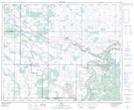
Maps showing Garry Trail, 14-44-8-W4, Alberta
Garry Trail is a Road feature located in 14-44-8-W4, Alberta.
- Latitude: 52° 46' 36'' North (decimal: 52.7766666)
- Longitude: 111° 3' 55'' West (decimal: -111.0652778)
- Topography Feature Category: Road feature
- Geographical Feature: Trail
- Canadian Province/Territory: Alberta
- Location: 14-44-8-W4
- Atlas of Canada Locator Map: Garry Trail
- GPS Coordinate Locator Map: Garry Trail Lat/Long