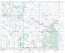
Maps showing Tower Hill, 11-44-8-W4, Alberta
Tower Hill is a Mountain located in 11-44-8-W4, Alberta and has an elevation of 679 meters.
- Latitude: 52° 46' 27'' North (decimal: 52.7741667)
- Longitude: 111° 3' 50'' West (decimal: -111.0638889)
- Topography Feature Category: Mountain
- Geographical Feature: Hill
- Canadian Province/Territory: Alberta
- Elevation: 679 meters
- Location: 11-44-8-W4
- Atlas of Canada Locator Map: Tower Hill
- GPS Coordinate Locator Map: Tower Hill Lat/Long