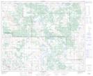
Maps showing Yak Lakes, 14-43-7-W4, Alberta
Yak Lakes is a Lake located in 14-43-7-W4, Alberta and has an elevation of 671 meters.
- Latitude: 52° 42' 2'' North (decimal: 52.7005555)
- Longitude: 110° 55' 16'' West (decimal: -110.9211110)
- Topography Feature Category: Lake
- Geographical Feature: Lakes
- Canadian Province/Territory: Alberta
- Elevation: 671 meters
- Location: 14-43-7-W4
- Atlas of Canada Locator Map: Yak Lakes
- GPS Coordinate Locator Map: Yak Lakes Lat/Long
Yak Lakes NTS Map Sheets