Maps showing Cattalo Lake, 22-44-7-W4, Alberta
Cattalo Lake is a Lake located in 22-44-7-W4, Alberta and has an elevation of 669 meters.
- Latitude: 52° 42' 50'' North (decimal: 52.7138889)
- Longitude: 110° 56' 00'' West (decimal: -110.9333333)
- Topography Feature Category: Lake
- Geographical Feature: Lake
- Canadian Province/Territory: Alberta
- Elevation: 669 meters
- Location: 22-44-7-W4
- Atlas of Canada Locator Map: Cattalo Lake
- GPS Coordinate Locator Map: Cattalo Lake Lat/Long
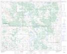
Cattalo Lake NTS Map Sheets