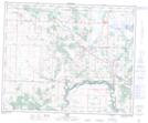
Maps showing Boston Hill, 29 and 30-40-24-W4, Alberta
Boston Hill is a Mountain located in 29 and 30-40-24-W4, Alberta.
- Latitude: 52° 28' 12'' North (decimal: 52.4700000)
- Longitude: 113° 26' 6'' West (decimal: -113.4349999)
- Topography Feature Category: Mountain
- Geographical Feature: Hill
- Canadian Province/Territory: Alberta
- Location: 29 and 30-40-24-W4
- Atlas of Canada Locator Map: Boston Hill
- GPS Coordinate Locator Map: Boston Hill Lat/Long