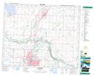
Maps showing Church Hill, 28-40-24-W4, Alberta
Church Hill is a Mountain located in 28-40-24-W4, Alberta.
- Latitude: 52° 27' 50'' North (decimal: 52.4638889)
- Longitude: 113° 31' 53'' West (decimal: -113.5313888)
- Topography Feature Category: Mountain
- Geographical Feature: Hill
- Canadian Province/Territory: Alberta
- Location: 28-40-24-W4
- Atlas of Canada Locator Map: Church Hill
- GPS Coordinate Locator Map: Church Hill Lat/Long