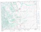
Maps showing Macabee Gap, 11-20-4-W5, Alberta
Macabee Gap is a Valley located in 11-20-4-W5, Alberta.
- Latitude: 50° 40' 52'' North (decimal: 50.6811111)
- Longitude: 114° 26' 24'' West (decimal: -114.4399999)
- Topography Feature Category: Valley
- Geographical Feature: Gap
- Canadian Province/Territory: Alberta
- Location: 11-20-4-W5
- Atlas of Canada Locator Map: Macabee Gap
- GPS Coordinate Locator Map: Macabee Gap Lat/Long
Macabee Gap NTS Map Sheets