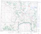
Maps showing Prospect Hill, 13-40-23-W4, Alberta
Prospect Hill is a Mountain located in 13-40-23-W4, Alberta.
- Latitude: 52° 26' 32'' North (decimal: 52.4422222)
- Longitude: 113° 10' 18'' West (decimal: -113.1716666)
- Topography Feature Category: Mountain
- Geographical Feature: Hill
- Canadian Province/Territory: Alberta
- Location: 13-40-23-W4
- Atlas of Canada Locator Map: Prospect Hill
- GPS Coordinate Locator Map: Prospect Hill Lat/Long