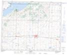
Maps showing Shuckburgh Slough, 1 and 2-39-20-W4, Alberta
Shuckburgh Slough is a Lake located in 1 and 2-39-20-W4, Alberta.
- Latitude: 52° 19' 3'' North (decimal: 52.3175000)
- Longitude: 112° 46' 1'' West (decimal: -112.7669443)
- Topography Feature Category: Lake
- Geographical Feature: Lake
- Canadian Province/Territory: Alberta
- Location: 1 and 2-39-20-W4
- Atlas of Canada Locator Map: Shuckburgh Slough
- GPS Coordinate Locator Map: Shuckburgh Slough Lat/Long