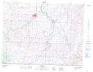
Maps showing Immigration Gap, 1-1-24 4W, Alberta
Immigration Gap is a Valley located in 1-1-24 4W, Alberta.
- Latitude: 48° 60' 00'' North (decimal: 48.9999999)
- Longitude: 113° 5' 51'' West (decimal: -113.0975829)
- Topography Feature Category: Valley
- Geographical Feature: Gap
- Canadian Province/Territory: Alberta
- Location: 1-1-24 4W
- Atlas of Canada Locator Map: Immigration Gap
- GPS Coordinate Locator Map: Immigration Gap Lat/Long
Immigration Gap NTS Map Sheets