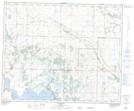
Maps showing Ferry Point, 32-43-18 4W, Alberta
Ferry Point is a Road feature located in 32-43-18 4W, Alberta.
- Latitude: 52° 44' 46'' North (decimal: 52.7461111)
- Longitude: 112° 34' 2'' West (decimal: -112.5672222)
- Topography Feature Category: Road feature
- Geographical Feature: Bridge
- Canadian Province/Territory: Alberta
- Location: 32-43-18 4W
- Atlas of Canada Locator Map: Ferry Point
- GPS Coordinate Locator Map: Ferry Point Lat/Long