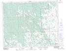
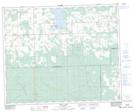
Maps showing Cranberry Creek, 15-44-7 5W., Alberta
Cranberry Creek is a River located in 15-44-7 5W., Alberta and has an elevation of 989 meters.
- Latitude: 52° 47' 23'' North (decimal: 52.7897222)
- Longitude: 114° 55' 47'' West (decimal: -114.9297221)
- Topography Feature Category: River
- Geographical Feature: Creek
- Canadian Province/Territory: Alberta
- Elevation: 989 meters
- Location: 15-44-7 5W.
- Atlas of Canada Locator Map: Cranberry Creek
- GPS Coordinate Locator Map: Cranberry Creek Lat/Long
Cranberry Creek NTS Map Sheets