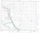
Maps showing Spruce Coulee, 3-42-17 4W, Alberta
Spruce Coulee is a Valley located in 3-42-17 4W, Alberta.
- Latitude: 52° 35' 53'' North (decimal: 52.5980555)
- Longitude: 112° 24' 34'' West (decimal: -112.4094443)
- Topography Feature Category: Valley
- Geographical Feature: Coulee
- Canadian Province/Territory: Alberta
- Location: 3-42-17 4W
- Atlas of Canada Locator Map: Spruce Coulee
- GPS Coordinate Locator Map: Spruce Coulee Lat/Long
Spruce Coulee NTS Map Sheets