Canada Topographic Maps

Adskwatim Creek Topo Maps

Topography maps and Latitude/Longitude Location

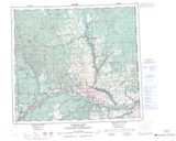
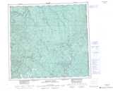
Maps showing Adskwatim Creek, 94-13-W6, Alberta

Adskwatim Creek is a River located in 94-13-W6, Alberta and has an elevation of 783 meters.

  • Latitude: 57° 11' 7'' North   (decimal: 57.1852777)
  • Longitude: 120° 0' 5'' West   (decimal: -120.0013888)
  • Topography Feature Category: River
  • Geographical Feature: Creek
  • Canadian Province/Territory: Alberta
  • Elevation: 783 meters
  • Location: 94-13-W6
  • Atlas of Canada Locator Map: Adskwatim Creek
  • GPS Coordinate Locator Map: Adskwatim Creek Lat/Long

Adskwatim Creek NTS Map Sheets

084E04 Mearon Creek Topographic Map at 1:50,000 scale

094A16 Doig River Topographic Map at 1:50,000 scale

094H01 Adskwatim Creek Topographic Map at 1:50,000 scale

084E Chinchaga River Topographic Map at 1:250,000 scale

094A Charlie Lake Topographic Map at 1:250,000 scale

094H Beatton River Topographic Map at 1:250,000 scale

 
Buy Topographic Maps DVD
Newsletter Sign-up

Yes, I want to receive map store discounts.


Bookmark and Share