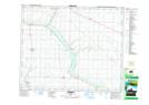
Maps showing Little Beaver Lake, 43,44-21-W4, Alberta
Little Beaver Lake is a Lake located in 43,44-21-W4, Alberta and has an elevation of 754 meters.
- Latitude: 52° 46' 21'' North (decimal: 52.7724999)
- Longitude: 112° 58' 45'' West (decimal: -112.9791667)
- Topography Feature Category: Lake
- Geographical Feature: Lake
- Canadian Province/Territory: Alberta
- Elevation: 754 meters
- Location: 43,44-21-W4
- Atlas of Canada Locator Map: Little Beaver Lake
- GPS Coordinate Locator Map: Little Beaver Lake Lat/Long