Maps showing Dutch Flats, 43-22-W4, Alberta
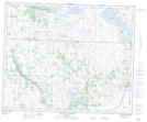
Dutch Flats is a Low vegetation located in 43-22-W4, Alberta.
- Latitude: 52° 43' 38'' North (decimal: 52.7272222)
- Longitude: 113° 7' 31'' West (decimal: -113.1252777)
- Topography Feature Category: Low vegetation
- Geographical Feature: Flats
- Canadian Province/Territory: Alberta
- Location: 43-22-W4
- Atlas of Canada Locator Map: Dutch Flats
- GPS Coordinate Locator Map: Dutch Flats Lat/Long
Dutch Flats NTS Map Sheets