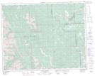
Maps showing Forgetmenot Pond, 24-21-7-W5, Alberta
Forgetmenot Pond is a Lake located in 24-21-7-W5, Alberta.
- Latitude: 50° 48' 7'' North (decimal: 50.8019444)
- Longitude: 114° 50' 36'' West (decimal: -114.8433333)
- Topography Feature Category: Lake
- Geographical Feature: Pond
- Canadian Province/Territory: Alberta
- Location: 24-21-7-W5
- Atlas of Canada Locator Map: Forgetmenot Pond
- GPS Coordinate Locator Map: Forgetmenot Pond Lat/Long
Forgetmenot Pond NTS Map Sheets