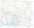
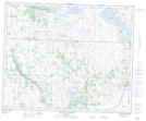
Maps showing Jarvis Bay, 17,18,19,20,29,30-41-21-W4, Alberta
Jarvis Bay is a Bay located in 17,18,19,20,29,30-41-21-W4, Alberta.
- Latitude: 52° 32' 48'' North (decimal: 52.5466666)
- Longitude: 112° 59' 39'' West (decimal: -112.9941667)
- Topography Feature Category: Bay
- Geographical Feature: Bay
- Canadian Province/Territory: Alberta
- Location: 17,18,19,20,29,30-41-21-W4
- Atlas of Canada Locator Map: Jarvis Bay
- GPS Coordinate Locator Map: Jarvis Bay Lat/Long
Jarvis Bay NTS Map Sheets