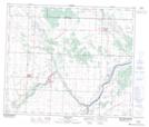
Maps showing Kimura Lake, 29-57-22-W4, Alberta
Kimura Lake is a Lake located in 29-57-22-W4, Alberta.
- Latitude: 53° 57' 12'' North (decimal: 53.9533333)
- Longitude: 113° 14' 20'' West (decimal: -113.2388888)
- Topography Feature Category: Lake
- Geographical Feature: Lake
- Canadian Province/Territory: Alberta
- Location: 29-57-22-W4
- Atlas of Canada Locator Map: Kimura Lake
- GPS Coordinate Locator Map: Kimura Lake Lat/Long