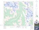
Maps showing Caldron Creek, Alberta
Caldron Creek is a River located in Alberta and has an elevation of 2171 meters.
- Latitude: 51° 41' 50'' North (decimal: 51.6972222)
- Longitude: 116° 32' 8'' West (decimal: -116.5355555)
- Topography Feature Category: River
- Geographical Feature: Creek
- Canadian Province/Territory: Alberta
- Elevation: 2171 meters
- Atlas of Canada Locator Map: Caldron Creek
- GPS Coordinate Locator Map: Caldron Creek Lat/Long
Caldron Creek NTS Map Sheets