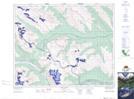
Maps showing Coleman Lake, Alberta
Coleman Lake is a Lake located in Alberta.
- Latitude: 52° 7' 53'' North (decimal: 52.1313888)
- Longitude: 116° 56' 57'' West (decimal: -116.9491667)
- Topography Feature Category: Lake
- Geographical Feature: Lake
- Canadian Province/Territory: Alberta
- Atlas of Canada Locator Map: Coleman Lake
- GPS Coordinate Locator Map: Coleman Lake Lat/Long
Coleman Lake NTS Map Sheets