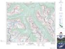
Maps showing Mistaya Canyon, Alberta
Mistaya Canyon is a Valley located in Alberta and has an elevation of 1498 meters.
- Latitude: 51° 57' 1'' North (decimal: 51.9502777)
- Longitude: 116° 43' 0'' West (decimal: -116.7166667)
- Topography Feature Category: Valley
- Geographical Feature: Canyon
- Canadian Province/Territory: Alberta
- Elevation: 1498 meters
- Atlas of Canada Locator Map: Mistaya Canyon
- GPS Coordinate Locator Map: Mistaya Canyon Lat/Long
Mistaya Canyon NTS Map Sheets