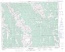
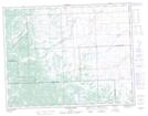
Maps showing Cutthroat Creek, 33-17-4-W5M, Alberta
Cutthroat Creek is a River located in 33-17-4-W5M, Alberta.
- Latitude: 50° 28' 42'' North (decimal: 50.4783333)
- Longitude: 114° 29' 23'' West (decimal: -114.4897221)
- Topography Feature Category: River
- Geographical Feature: Creek
- Canadian Province/Territory: Alberta
- Location: 33-17-4-W5M
- Atlas of Canada Locator Map: Cutthroat Creek
- GPS Coordinate Locator Map: Cutthroat Creek Lat/Long
Cutthroat Creek NTS Map Sheets