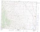
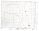
Maps showing Quail Coulee, 30,36-12-30-W4 and N1/2 19-12-29-W4, Alberta
Quail Coulee is a Valley located in 30,36-12-30-W4 and N1/2 19-12-29-W4, Alberta.
- Latitude: 49° 59' 40'' North (decimal: 49.9944444)
- Longitude: 113° 57' 35'' West (decimal: -113.9597222)
- Topography Feature Category: Valley
- Geographical Feature: Coulee
- Canadian Province/Territory: Alberta
- Location: 30,36-12-30-W4 and N1/2 19-12-29-W4
- Atlas of Canada Locator Map: Quail Coulee
- GPS Coordinate Locator Map: Quail Coulee Lat/Long
Quail Coulee NTS Map Sheets