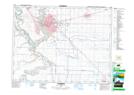
Maps showing Davis Bottom, SW24-9-22-4, Alberta
Davis Bottom is a Low vegetation located in SW24-9-22-4, Alberta.
- Latitude: 49° 44' 37'' North (decimal: 49.7436110)
- Longitude: 112° 51' 57'' West (decimal: -112.8658333)
- Topography Feature Category: Low vegetation
- Geographical Feature: Bottom
- Canadian Province/Territory: Alberta
- Location: SW24-9-22-4
- Atlas of Canada Locator Map: Davis Bottom
- GPS Coordinate Locator Map: Davis Bottom Lat/Long
Davis Bottom NTS Map Sheets