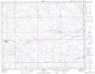
Maps showing Hoenig's Hill, 28-1,2-W4, Alberta
Hoenig's Hill is a Mountain located in 28-1,2-W4, Alberta.
- Latitude: 51° 24' 12'' North (decimal: 51.4033333)
- Longitude: 110° 8' 43'' West (decimal: -110.1452777)
- Topography Feature Category: Mountain
- Geographical Feature: Hill
- Canadian Province/Territory: Alberta
- Location: 28-1,2-W4
- Atlas of Canada Locator Map: Hoenig's Hill
- GPS Coordinate Locator Map: Hoenig's Hill Lat/Long