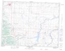
Maps showing Kettles Creek, 25-6-30-W4, Alberta
Kettles Creek is a River located in 25-6-30-W4, Alberta.
- Latitude: 49° 29' 53'' North (decimal: 49.4980555)
- Longitude: 113° 55' 31'' West (decimal: -113.9252777)
- Topography Feature Category: River
- Geographical Feature: Creek
- Canadian Province/Territory: Alberta
- Location: 25-6-30-W4
- Atlas of Canada Locator Map: Kettles Creek
- GPS Coordinate Locator Map: Kettles Creek Lat/Long
Kettles Creek NTS Map Sheets