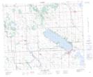
Maps showing Nuorison Creek, 10,11,12,13-39-3-W5, Alberta
Nuorison Creek is a River located in 10,11,12,13-39-3-W5, Alberta.
- Latitude: 52° 20' 34'' North (decimal: 52.3427778)
- Longitude: 114° 21' 5'' West (decimal: -114.3513888)
- Topography Feature Category: River
- Geographical Feature: Creek
- Canadian Province/Territory: Alberta
- Location: 10,11,12,13-39-3-W5
- Atlas of Canada Locator Map: Nuorison Creek
- GPS Coordinate Locator Map: Nuorison Creek Lat/Long
Nuorison Creek NTS Map Sheets