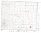
Maps showing Table Butte, 8-14-28-W4, Alberta
Table Butte is a Mountain located in 8-14-28-W4, Alberta.
- Latitude: 50° 9' 50'' North (decimal: 50.1638889)
- Longitude: 113° 46' 36'' West (decimal: -113.7766667)
- Topography Feature Category: Mountain
- Geographical Feature: Butte
- Canadian Province/Territory: Alberta
- Location: 8-14-28-W4
- Atlas of Canada Locator Map: Table Butte
- GPS Coordinate Locator Map: Table Butte Lat/Long
Table Butte NTS Map Sheets