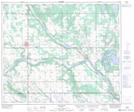
Maps showing Telegraph Creek, 17-56-5-W4, Alberta
Telegraph Creek is a River located in 17-56-5-W4, Alberta and has an elevation of 551 meters.
- Latitude: 53° 50' 10'' North (decimal: 53.8361110)
- Longitude: 110° 42' 58'' West (decimal: -110.7161111)
- Topography Feature Category: River
- Geographical Feature: Creek
- Canadian Province/Territory: Alberta
- Elevation: 551 meters
- Location: 17-56-5-W4
- Atlas of Canada Locator Map: Telegraph Creek
- GPS Coordinate Locator Map: Telegraph Creek Lat/Long
Telegraph Creek NTS Map Sheets