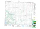
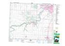
Maps showing West Whitemud Creek, 31-49-25-W4, Alberta
West Whitemud Creek is a River located in 31-49-25-W4, Alberta.
- Latitude: 53° 16' 26'' North (decimal: 53.2738888)
- Longitude: 113° 38' 24'' West (decimal: -113.6399999)
- Topography Feature Category: River
- Geographical Feature: Creek
- Canadian Province/Territory: Alberta
- Location: 31-49-25-W4
- Atlas of Canada Locator Map: West Whitemud Creek
- GPS Coordinate Locator Map: West Whitemud Creek Lat/Long
West Whitemud Creek NTS Map Sheets