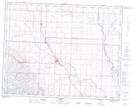
Maps showing Williams Coulee, 15,16-16-29-W4, Alberta
Williams Coulee is a Valley located in 15,16-16-29-W4, Alberta.
- Latitude: 50° 21' 11'' North (decimal: 50.3530555)
- Longitude: 113° 57' 33'' West (decimal: -113.9591666)
- Topography Feature Category: Valley
- Geographical Feature: Coulee
- Canadian Province/Territory: Alberta
- Location: 15,16-16-29-W4
- Atlas of Canada Locator Map: Williams Coulee
- GPS Coordinate Locator Map: Williams Coulee Lat/Long