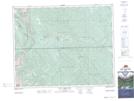
Maps showing Winchester Creek, Alberta
Winchester Creek is a River located in Alberta and has an elevation of 1638 meters.
- Latitude: 51° 37' 1'' North (decimal: 51.6169444)
- Longitude: 115° 28' 32'' West (decimal: -115.4755556)
- Topography Feature Category: River
- Geographical Feature: Creek
- Canadian Province/Territory: Alberta
- Elevation: 1638 meters
- Atlas of Canada Locator Map: Winchester Creek
- GPS Coordinate Locator Map: Winchester Creek Lat/Long
Winchester Creek NTS Map Sheets