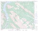
Maps showing Mount William Booth, 36-17-W5, Alberta
Mount William Booth is a Mountain located in 36-17-W5, Alberta and has an elevation of 2495 meters.
- Latitude: 52° 5' 22'' North (decimal: 52.0894444)
- Longitude: 116° 19' 14'' West (decimal: -116.3205555)
- Topography Feature Category: Mountain
- Geographical Feature: Mount
- Canadian Province/Territory: Alberta
- Elevation: 2495 meters
- Location: 36-17-W5
- Atlas of Canada Locator Map: Mount William Booth
- GPS Coordinate Locator Map: Mount William Booth Lat/Long
Mount William Booth NTS Map Sheets