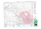
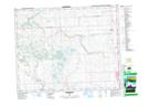
Maps showing Big Hill Springs Provincial Park, 26-3-W5, Alberta
Big Hill Springs Provincial Park is a Conservation area located in 26-3-W5, Alberta and has an elevation of 1247 meters.
- Latitude: 51° 15' 6'' North (decimal: 51.2516666)
- Longitude: 114° 23' 13'' West (decimal: -114.3869443)
- Topography Feature Category: Conservation area
- Geographical Feature: Provincial Park
- Canadian Province/Territory: Alberta
- Elevation: 1247 meters
- Location: 26-3-W5
- Atlas of Canada Locator Map: Big Hill Springs Provincial Park
- GPS Coordinate Locator Map: Big Hill Springs Provincial Park Lat/Long
Big Hill Springs Provincial Park NTS Map Sheets