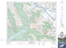
Maps showing Christian Peak, Alberta
Christian Peak is a Mountain located in Alberta and has an elevation of 3150 meters.
- Latitude: 51° 56' 37'' North (decimal: 51.9436111)
- Longitude: 117° 5' 52'' West (decimal: -117.0977777)
- Topography Feature Category: Mountain
- Geographical Feature: Peak
- Canadian Province/Territory: Alberta
- Elevation: 3150 meters
- Atlas of Canada Locator Map: Christian Peak
- GPS Coordinate Locator Map: Christian Peak Lat/Long
Christian Peak NTS Map Sheets