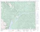
Maps showing Brazeau Mine Pit, 32-40-15-W5, Alberta
Brazeau Mine Pit is a Lake located in 32-40-15-W5, Alberta.
- Latitude: 52° 29' 5'' North (decimal: 52.4847222)
- Longitude: 116° 7' 44'' West (decimal: -116.1288888)
- Topography Feature Category: Lake
- Geographical Feature: Lake
- Canadian Province/Territory: Alberta
- Location: 32-40-15-W5
- Atlas of Canada Locator Map: Brazeau Mine Pit
- GPS Coordinate Locator Map: Brazeau Mine Pit Lat/Long
Brazeau Mine Pit NTS Map Sheets