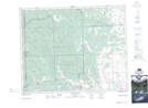
Maps showing Réserve indienne Stony 142B, Alberta
Réserve indienne Stony 142B is a Indian Reserve located in Alberta.
- Latitude: 51° 18' North (decimal: 51.2999999)
- Longitude: 114° 45' West (decimal: -114.7499999)
- Topography Feature Category: Indian Reserve
- Geographical Feature: Réserve indienne
- Canadian Province/Territory: Alberta
- GPS Coordinate Locator Map: Réserve indienne Stony 142B Lat/Long
Réserve indienne Stony 142B NTS Map Sheets