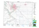
Maps showing Champ de tir Lethbridge, Alberta
Champ de tir Lethbridge is a Military area located in Alberta and has an elevation of 839 meters.
- Latitude: 49° 43' North (decimal: 49.7167000)
- Longitude: 112° 51' West (decimal: -112.8500000)
- Topography Feature Category: Military area
- Geographical Feature: C.M.F.C.
- Canadian Province/Territory: Alberta
- Elevation: 839 meters
- Atlas of Canada Locator Map: Champ de tir Lethbridge
- GPS Coordinate Locator Map: Champ de tir Lethbridge Lat/Long
Champ de tir Lethbridge NTS Map Sheets