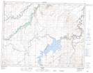
Maps showing Standoff Fort (Whiskey Post) Provincial Historic Site (Undeveloped), 6-25-W4, Alberta
Standoff Fort (Whiskey Post) Provincial Historic Site (Undeveloped) is a Conservation area located in 6-25-W4, Alberta.
- Latitude: 49° 29' North (decimal: 49.4833000)
- Longitude: 113° 19' West (decimal: -113.3167000)
- Topography Feature Category: Conservation area
- Geographical Feature: Provincial Historic Site
- Canadian Province/Territory: Alberta
- Location: 6-25-W4
- Atlas of Canada Locator Map: Standoff Fort (Whiskey Post) Provincial Historic Site (Undeveloped)
- GPS Coordinate Locator Map: Standoff Fort (Whiskey Post) Provincial Historic Site (Undeveloped) Lat/Long