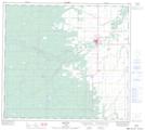
Maps showing Plavin Homestead Provincial Historic Site (Undeveloped), 90-23-W5, Alberta
Plavin Homestead Provincial Historic Site (Undeveloped) is a Conservation area located in 90-23-W5, Alberta.
- Latitude: 56° 50' North (decimal: 56.8333000)
- Longitude: 117° 38' West (decimal: -117.6333000)
- Topography Feature Category: Conservation area
- Geographical Feature: Provincial Historic Site
- Canadian Province/Territory: Alberta
- Location: 90-23-W5
- Atlas of Canada Locator Map: Plavin Homestead Provincial Historic Site (Undeveloped)
- GPS Coordinate Locator Map: Plavin Homestead Provincial Historic Site (Undeveloped) Lat/Long
Plavin Homestead Provincial Historic Site (Undeveloped) NTS Map Sheets