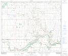
Maps showing Grizzly Bear Telegraph Station Provincial Historic Site (Undeveloped), 48-5-W4, Alberta
Grizzly Bear Telegraph Station Provincial Historic Site (Undeveloped) is a Conservation area located in 48-5-W4, Alberta.
- Latitude: 53° 9' North (decimal: 53.1500000)
- Longitude: 110° 43' West (decimal: -110.7167000)
- Topography Feature Category: Conservation area
- Geographical Feature: Provincial Historic Site
- Canadian Province/Territory: Alberta
- Location: 48-5-W4
- Atlas of Canada Locator Map: Grizzly Bear Telegraph Station Provincial Historic Site (Undeveloped)
- GPS Coordinate Locator Map: Grizzly Bear Telegraph Station Provincial Historic Site (Undeveloped) Lat/Long
Grizzly Bear Telegraph Station Provincial Historic Site (Undeveloped) NTS Map Sheets