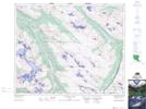
Maps showing Mount GEC, Winston Churchill, Alberta
Mount GEC is a Mountain located in Winston Churchill, Alberta.
- Latitude: 52° 20' 11'' North (decimal: 52.3363888)
- Longitude: 117° 27' 0'' West (decimal: -117.4500000)
- Topography Feature Category: Mountain
- Geographical Feature: Mount
- Canadian Province/Territory: Alberta
- Location: Winston Churchill
- Atlas of Canada Locator Map: Mount GEC
- GPS Coordinate Locator Map: Mount GEC Lat/Long
Mount GEC NTS Map Sheets