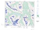
Maps showing Blackfriar Peak, Alberta
Blackfriar Peak is a Mountain located in Alberta.
- Latitude: 52° 19' 35'' North (decimal: 52.3263999)
- Longitude: 117° 36' 59'' West (decimal: -117.6164000)
- Topography Feature Category: Mountain
- Geographical Feature: Peak
- Canadian Province/Territory: Alberta
- GPS Coordinate Locator Map: Blackfriar Peak Lat/Long
Blackfriar Peak NTS Map Sheets