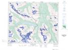
Maps showing Mount Palmer, Winston Churchill, Alberta
Mount Palmer is a Mountain located in Winston Churchill, Alberta.
- Latitude: 52° 21' 10'' North (decimal: 52.3527777)
- Longitude: 117° 31' 14'' West (decimal: -117.5205556)
- Topography Feature Category: Mountain
- Geographical Feature: Mount
- Canadian Province/Territory: Alberta
- Location: Winston Churchill
- Atlas of Canada Locator Map: Mount Palmer
- GPS Coordinate Locator Map: Mount Palmer Lat/Long
Mount Palmer NTS Map Sheets