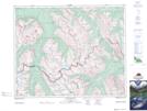
Maps showing Clearwater Lake, Alberta
Clearwater Lake is a Lake located in Alberta and has an elevation of 1966 meters.
- Latitude: 51° 46' 28'' North (decimal: 51.7744444)
- Longitude: 116° 8' 53'' West (decimal: -116.1480555)
- Topography Feature Category: Lake
- Geographical Feature: Lake
- Canadian Province/Territory: Alberta
- Elevation: 1966 meters
- Atlas of Canada Locator Map: Clearwater Lake
- GPS Coordinate Locator Map: Clearwater Lake Lat/Long
Clearwater Lake NTS Map Sheets