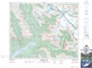
Maps showing Oppy Mountain, Alberta
Oppy Mountain is a Mountain located in Alberta and has an elevation of 2881 meters.
- Latitude: 51° 58' 24'' North (decimal: 51.9733333)
- Longitude: 117° 8' 51'' West (decimal: -117.1474999)
- Topography Feature Category: Mountain
- Geographical Feature: Mountain
- Canadian Province/Territory: Alberta
- Elevation: 2881 meters
- Atlas of Canada Locator Map: Oppy Mountain
- GPS Coordinate Locator Map: Oppy Mountain Lat/Long
Oppy Mountain NTS Map Sheets