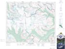
Maps showing The Castelets, Alberta
The Castelets is a Mountain located in Alberta and has an elevation of 2433 meters.
- Latitude: 52° 3' 33'' North (decimal: 52.0591666)
- Longitude: 117° 7' 32'' West (decimal: -117.1255555)
- Topography Feature Category: Mountain
- Geographical Feature: Mountain
- Canadian Province/Territory: Alberta
- Elevation: 2433 meters
- Atlas of Canada Locator Map: The Castelets
- GPS Coordinate Locator Map: The Castelets Lat/Long
The Castelets NTS Map Sheets