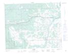
Maps showing McDougall Flats, 31-32-5-W5, Alberta
McDougall Flats is a Low vegetation located in 31-32-5-W5, Alberta.
- Latitude: 51° 47' 33'' North (decimal: 51.7924999)
- Longitude: 114° 42' 11'' West (decimal: -114.7030556)
- Topography Feature Category: Low vegetation
- Geographical Feature: Flats
- Canadian Province/Territory: Alberta
- Location: 31-32-5-W5
- Atlas of Canada Locator Map: McDougall Flats
- GPS Coordinate Locator Map: McDougall Flats Lat/Long