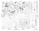
Maps showing Flat Cabin Lake, 6-103-6-W4, Alberta
Flat Cabin Lake is a Lake located in 6-103-6-W4, Alberta.
- Latitude: 57° 54' 37'' North (decimal: 57.9102777)
- Longitude: 110° 58' 42'' West (decimal: -110.9783333)
- Topography Feature Category: Lake
- Geographical Feature: Lake
- Canadian Province/Territory: Alberta
- Location: 6-103-6-W4
- Atlas of Canada Locator Map: Flat Cabin Lake
- GPS Coordinate Locator Map: Flat Cabin Lake Lat/Long